
There is a specific point in every long ride where the map ends and the true soul of the Philippines reveals its rugged and beautiful secrets.
You leave the familiar noise of the central provinces behind and head toward a horizon that feels endless and full of promise for the road ahead. Most travelers never make it this far north and they miss the rugged beauty that defines the very edge of our massive island archipelago.
The road to the northernmost tip of Luzon is paved with secrets that only the persistent and the curious will ever find in their travels.
The Starting Line: Tuguegarao City
Tuguegarao City is often described as the furnace of the Philippines and you feel that searing heat the moment the sun begins to climb over the valley.
The air is thick and smells like sunbaked earth mixed with the faint aroma of hand-pulled noodles drifting from the open windows of local kitchens. You realize that before you can tackle the northern highways you must first sit down and fuel your body with a bowl of something local.
Triangle Panciteria is a guardian of the city’s culinary heritage and has been serving its famous hand-pulled noodle recipes to locals and travelers since 1978. It is a humble and busy place where the constant clatter of pans and the steam from the Batil Patong creates a nostalgic atmosphere.
The noodles are topped with savory carabeef and a poached egg that breaks perfectly to create a rich and savory sauce over the fresh bean sprouts.
You take your time with the warm egg-drop soup served on the side because it provides the comfort you need before the long miles of asphalt. This is the last bit of urban bustle you will experience before the road turns into a quiet ribbon stretching toward the silent mountains.
Crossing the Golden Gate: Magapit Bridge
The highway straightens out as you leave the city limits and head toward the Lallo boundary where the Cagayan River begins to widen significantly today.
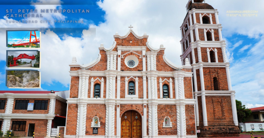
The landscape suddenly opens up to reveal a massive hanging structure that dominates the entire skyline like a giant steel gateway to the deep north.
This is the Magapit Bridge and it is often called the Golden Gate of Cagayan by the people who live in these quiet northern towns. It was the first hanging bridge of its kind in Southeast Asia and it stands as a marvel of engineering that connects the two banks.
Reaching the Milestone: Aparri Welcome Arc
Every Philippine Looper knows the significance of this specific coordinate as it marks a major milestone in any cross-country journey through the islands of the north.
You navigate through the quiet town to reach the weathered Punta Pier where the structures are rickety but hold a rugged and coastal beauty. On a clear day you can see the distant and mysterious silhouettes of the Babuyan Islands floating on the blue horizon like ghosts in the sea.
This is where the mighty Cagayan River finally meets the Babuyan Channel in a chaotic and beautiful clash of fresh and salt water.
You can smell the salt in the air and see the local fishermen laying out their harvest of gamet seaweed to dry on concrete.
The Edge of Luzon: San Vicente Port in Santa Ana
The road continues east toward the special economic zone of Santa Ana where the mountains meet the sea in a dramatic display of blue. This is a place where the wind tells stories of the Pacific Ocean and the air feels cleaner than any city you have ever visited.
You eventually reach the dead end of the northernmost road in Luzon at the busy San Vicente Port where the boats wait for passengers.
Standing here feels like standing at the absolute edge of the world while the waves crash against the rocks and the sea spray hits your face. You are exactly 642 kilometers away from the center of Manila and the distance makes you realize how vast and diverse our country truly is.
The Volcanic Trek: Climbing Mount Cagua in Gonzaga
The journey turns inland to face the challenge of an active volcano tucked away in the quiet and forested municipality of Gonzaga.
Mount Cagua requires an early start to beat the searing heat of the northern sun before the humidity becomes too heavy for a long climb.
The trail takes you through lush pineapple fields and windy ridges where the air cools significantly as you gain altitude over the valley.
You must navigate steep and muddy paths to reach the crater where the earth feels warm and the rocks are stained yellow and white. The scent of sulfur fills the air as you step onto the ground that proves the mountain is still alive and breathing deep below.
Practical Travel Tips for the Northern Luzon Loop
Travelers heading this far north should always make sure their fuel tanks are full before leaving the town centers of Tuguegarao or Santa Ana.
There are major gas stations available like Petron but the stretches of road between municipalities can be quite long and empty of any mechanical services. You should always carry enough cash as some of the smaller eateries and lodges in Gonzaga do not accept any form of digital payments.
The heat in Cagayan is intense so staying hydrated with plenty of water is essential for your safety and comfort during the long northern ride.
The road to the north is a reminder that the best things in life require a little bit of sweat and a lot of heart to find. Sometimes you have to ride to the very edge of the map just to realize that the journey itself was the home you were seeking all along.