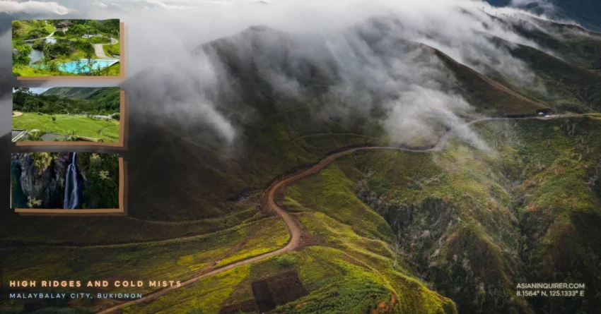
It only takes exactly two minutes to leave behind the noisy concrete edges of the city and enter a mountain range so vast that it seems to swallow the entire northern horizon of Bukidnon.
Most travelers who visit the highland province stay within the safe and predictable limits of the paved national highways and the busy commercial plazas of the downtown area. They never realize that a completely different kind of life is waiting for them just past the very last streetlamp of the town center where the mountains begin to rise.
I stood at the statues of the Kaamulan Rotonda and looked toward the jagged peaks where the morning mist was already starting to hug the deep green ridges of the horizon.
The Technical Path to Kibalabag
Finding your way to the remote and jagged ridges of Barangay Kibalabag is a profound test of your willingness to trust the gritty reality of the mountain dirt over the polished glow of a modern digital screen.
Google Maps will inevitably fail you in these specific coordinates because the most spectacular mountain passes and the winding hidden trails are not yet fully recorded on any standard satellite view or commercial database available to the public. You have to rely entirely on the ancient and inherited knowledge of the locals and a steady, patient hand on your motorcycle handlebars to successfully navigate the steep and unforgiving inclines.
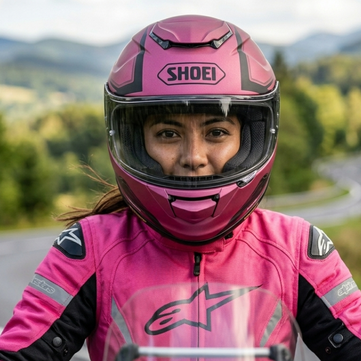
My trusty motorbike felt the sudden shift in terrain the moment the rubber of the tires touched the loose gravel and the sharp, weathered limestone of the rural mountain road. The off road mode became an absolute technical necessity as the climb grew significantly steeper and the air turned noticeably thinner with every kilometer we traveled away from the valley floor.
You begin to understand exactly why the local farmers and riders speak about these high ridges with a unique mix of deep-seated pride and genuine caution.
The Cold Sanctuary of Katihan Eco Park
I reached the wooden gates of Katihan Eco Park just as a heavy and swirling white blanket of mountain clouds began to roll over the dense forest canopy. This entrance fee is a symbolic amount that grants you access to a hidden world powered entirely by the natural flow of the cold mountain streams and the soft light of the morning sun.
You will notice immediately that there is no hum of an air conditioner or the spinning of an electric fan anywhere in the rustic rooms of the resort.
The natural temperature in this area stays remarkably low because of the high altitude and the thick insulation of the surrounding tropical mountains. It is the kind of place where you can actually hear the heavy silence of the earth between the rhythmic calls of the native birds hidden in the trees.
The High Altitude Perspective at Lions View
Leaving the quiet sanctuary of the eco park in the early morning light takes you even further into the rugged heart of the Bukidnon highlands toward the mountain community of Barangay Manalog.
This is the historic home of Lions View where the overlook is so breathtakingly dramatic that it feels like you are standing at the absolute edge of the known world. At a staggering 1,347 meters above the sea level of the coast you are standing much higher than most of the white clouds drifting slowly through the emerald valley below.
The winding trail here is a brutal gauntlet of sharp rocks and shifting sands that will test the absolute limits of your motorcycle suspension and your own physical endurance.
Reaching the summit allows you to bring your heavy motorcycle right to the edge of the precipice for a photograph that captures the raw and magnificent scale of the Visayan landscape.
The Hidden Roar of Kinapuntan Falls
The final and grueling descent toward the hidden Kinapuntan Falls is a high stakes exercise in technical troubleshooting and mental focus for any experienced motorcycle rider. You can actually feel the intense heat radiating from your metallic brake pads as you slowly navigate the steep and dangerously muddy switchbacks that lead down into the rocky river basin.
The sudden sound of crashing water finally pierces the heavy forest quiet and signals that you have successfully reached the primary source of life for the entire Cagayan de Oro region.
Seeing that magnificent and heavy curtain of white water crashing against the ancient mossy stone makes every physical struggle of the long journey feel completely worth the sweat and effort. The pool at the base of the waterfall is crystal clear and so piercingly cold that it effectively resets your entire nervous system the very second your skin touches the water.
Practical Travel Tips for the DIY Explorer
Start your mountain expedition at the Kaamulan Rotonda very early in the morning to beat the intense tropical heat of the lowlands before the sun reaches its peak.
Pack a windproof riding jacket and a heavy duty power bank because the mountain draft is freezing and the available charging ports in the huts are limited.
Ensure your motorcycle has high ground clearance and aggressive tread on your tires to handle the dangerously loose gravel sections found throughout the Kibalabag trails.
You should always carry a sufficient supply of drinking water and enough local currency in cash because ATMs and digital payment terminals are entirely non existent once you enter the remote mountain barangays.
Respect the deep tribal heritage of the Bukidnon people and always maintain a quiet and respectful presence during your trek through their ancestral and sacred lands.
We often spend our entire lives looking for the easy and clear road only to realize that the most profound clarity is found in the middle of a difficult and unexpected turn.
I hope your next journey leads you to a specific coordinate that makes you realize how vast and mysterious our islands truly are. The road is open and the mountains are waiting for your own personal story to begin.
Frequently Asked Questions
1. Where is the jump-off point for Kibalabag?
The journey begins at the Kaamulan Rotonda in Malaybalay City, Bukidnon, which is easily accessible via the Sayre Highway.
2. What is the best time of day to see the sea of clouds?
The optimal window for viewing the thick cloud formations is between 5:30 AM and 6:30 AM before the sun disperses the mist.
3. Do I need a professional guide to reach Kinapuntan Falls?
While the path is visible, hiring a local guide from Barangay Manalog is highly recommended to help navigate the steepest off-road sections safely.
4. Can a standard automatic scooter reach Lions View?
It is possible for experienced riders, but a high-clearance motorcycle or a semi-automatic bike is much safer for the large rocks and deep ruts.
5. How much is the entrance fee for Katihan Eco Park?
The entrance fee is approximately 100 pesos for day tours, which includes access to the natural spring pool and viewing decks.
6. Is there a mobile signal in Barangay Manalog?
Surprisingly, there is a stable signal for major networks like Globe and Smart at high points like Lions View, though it vanishes in the valleys.
7. Are there restaurants in the mountain barangays?
Options are very limited to small carinderias, so it is best to eat a heavy meal in Malaybalay City or bring your own provisions.
8. Is it safe to travel to these areas alone?
The communities are very welcoming, but it is always safer to ride with a buddy in case of mechanical issues on the remote trails.
9. What should I wear for the mountain ride?
Layers are essential. Wear a breathable base layer for the city and a windproof or padded jacket for the freezing temperatures in the highlands.
10. Can I stay overnight at Lions View?
Yes, there are basic cabins and camping grounds available for rent, but you must bring your own sleeping bags and thick blankets for the cold.